Best GPS for India?

gobble

Well-Known Member
Joined
Sep 23, 2008
Messages
5,348
Points
113
Location
Bangalore
After spending 4 hours hopelessly lost in bangalore roads yesterday, I've decided to get a pocket GPS. Which one is best for India locations? Should fit in trouser or shirt pocket. Ideally I want one that will attach to my iPod Touch 3G like this one.
https://www.orangegadgets.com/shop/..._id=1&osCsid=795ea8de33e4e3c5eeaada40d1096927

I need something with India maps and that will work without wireless connection. Hence need your sugesstions on what to avoid and what to check out.

I also intend to use this while trekking, so I need an application that has or will allow me to download maps of remote places in India as well.

Edit: This means the GPS should allow downloading terrain maps as well as road maps.

TIA for your suggestions.

Regards
 
Last edited:
Gobble,

Very pertinent question. I was casually looking around for the same and I have heard good things about this company: MapmyIndia.com Online maps, GPS Navigation, Driving Directions, Local Search

They have their own India maps database which is supposed to be fairly up-to-date. Caveat is I think you have to buy the GPS device from them, preloaded with the maps. I do not know whether any GPS device will work with their software. I don't see any reason why it shouldn't but I remember this as a drawback. You can always call them and check.

-Jinx.
 
MapMyIndia do provide maps for other devices: certain Garmin devices are listed as compatible, and I think they sell their maps for some phone GPSs too.

Remember that maps and, for some models, even navigation, come free with GPS-enabled Nokia phones. I can't follow my N82 while driving, but it helps to get me unlost sometimes!

What differs, between the various map providers, is the coverage. Whilst all are probably as good as each other at the metros, check out if the cover your village, travel destination, etc. My Nokia is fine for travel around Chennai, but it soon runs out as I leave the city.

Thanks I was considering the Nokia earlier. which model do you have? Does it have announcements ? There is a motorola Droid phone called Millenium that has maps for 400 Indian cities downloaded in its memory. But that means spending 20+K on another pocket device. How much does the Nokia cost with maps? I am thinking I will explore the possibility of purchasing software for iPod Touch that will have download-able city as well as remote area terrain maps and use a device like this Dual GPS Navigation and Battery Cradle - Apple Store (U.S.) instead. That way I can keep a cheap and durable phone instead and spend the money on the iPod accessory.

Edit: I dont want a third accessory device for GPS. However my post has been general because I want to learn what is best choice in India.

Regards
 
Last edited:
I have N82, and the screen is far too small for navigation, but it does help one find one's way around. Recently Nokia announced that Navigation would free, but it has not yet encompassed all models.

Please note that Nokia maps are free for all Nokia GPS phones. This means position finding and tracking is there, out of the box. Please also note that, although AGPS (which uses the cell signal to help the phone get a fix) is an option, it is not necessary, and GPS will work without any data traffic whatsoever. This also applies to the maps: they are stored on the device, and only downloaded when you specifically add new countries. I have India, UK and Singapore on my phone.

Navigation, which means the ability to plot routes and give voice directions, used to be chargeable by subscription on Nokia phones; it is this they have now made free --- but not available for all models

I am really not much good at the technical stuff about GPS: there are a number of good threads on Team-BHP.
 
Hmm... I too need something like this very badly. Like my wife says even a primary school child is better at finding ways than me.

I was thinking about fitting a GPS system for the car. What would the pros and cons be in that case, Thad? I guess it all works out to the same expense more or less, right? Instead of a new phone why not fit a car GPS system which can read out instructions and plot routes etc. etc.? Your thoughts?
 
yesterday we went out for tracking somewhere near bangalore. The place is around 45 KM from Banargatta Road/Bangalore. We used iPhone/Airtel GPS service to locate the place and direction. The accuracy was amazing and it was able to deliver shortest path through a small village for our destination. Road was very narrow and single car can go through. Every 50 Meter you drive in the village and you find intersection. You will not have any clue where to go. Thanks for iPhone we managed without asking anyone. Believe me without iPhone we would have spent 1 Hr extra to ask people. The only place was the top of hill where we didn't get Airtel Signal.

Now, we are planning more such trips as the last hurdle, getting to place without proper direction is eliminated by iPhone/Airtel.
 
I am using a Nokia 5800 for GPS , its good but takes a long time to track down the GPS satellites.
 
thevortex said:
Hmm... I too need something like this very badly. Like my wife says even a primary school child is better at finding ways than me.

I was thinking about fitting a GPS system for the car. What would the pros and cons be in that case, Thad? I guess it all works out to the same expense more or less, right? Instead of a new phone why not fit a car GPS system which can read out instructions and plot routes etc. etc.? Your thoughts?
The advantage being you've just one device to lug around. Mapmyindia is available for mobile phone as well, costs around 3000 for BB, Iphone, Symbian and droid. From what ive been reading it works perfectly within the city. Once you head outside the city it can become erroneous.

I'm planning to get it installed on my Windows mobile but I always rely upon human gps. Just stop the vehicle and ask :)

Advantages of separate device would be that anyone within your friends & family could use that since you'll be holding the phone. Also Dedicated GPS device locate you faster than the mobile version, but it wouldn't bother me a lot.


Sent from my iPhone using Tapatalk

For now I dont plan on getting an iPhone or something like that. And given that the phones would require one to actually stop the vehicle and do some consulting before one can get to grips with where one is, I thought the dedicated car GPS option might be better?

Yes, that still leaves the issue that the GPS is tied to my car and I would still be lost when I go by motorbike :).

Tell me another thing. What is it that these companies like mapmyindia offer over and above the free facility that Google Maps offers? I know that I can get Google maps on my current Sony Ericsson mobile. So what would I gain if I get something like mapmyindia - even on mobile?
 
And given that the phones would require one to actually stop the vehicle and do some consulting before one can get to grips with where one is, I thought the dedicated car GPS option might be better?

Yes, that still leaves the issue that the GPS is tied to my car and I would still be lost when I go by motorbike :).

Why stop? Never heard of such a thing. I was actually thinking of a GPS device that is also like a remote controller that will stop a satellite in its tracks and make it heed my commands before proceeding in its orbit :D

All you need is a car windscreen holder suction attachment. The navigation s/w announces the next left or right turn and you can glance at the map hands free whenever needed.

On a mobike, the earphone will announce each turn anyways and you ca n also slow down and check the pocketed GPS screen with one hand. Else you can consider attaching the car windshield suction holder on your mobike speedometer glass. :)

Regards
 
The GPS I have seen in US taxis are awesome. I also saw one in a Meru cab from Bangalore airport. I am looking at the same functionality with option of downloadable 1:20000 terrain maps for remote areas of India.

Regards
 
Tell me another thing. What is it that these companies like mapmyindia offer over and above the free facility that Google Maps offers? I know that I can get Google maps on my current Sony Ericsson mobile. So what would I gain if I get something like mapmyindia - even on mobile?

Mapmyindia maps are an offline copy of the map available online. So you don't have to depend on the GPRS signals which takes ages to load on our phone. Also finding alternative roads, avoiding particular cities work in those maps. I tried doing that in Google maps online and couldn't find the option.
 
My thoughts, personally, are that I am waiting for big price reductions in models with seven-inch or bigger screens. This is because I need reading glasses to take in the detail on the smaller screen, which means stopping to look at it.

I also don't consider Navteq (Nokia) or Garmin or Satnav coverage to be good enough yet, except for city itself. For instance, I took a trip to visit someone in Minjur, a few km north of Chennai. Not on my Nokia map. Now... what I can do is enter the lat/long, so that, once I fall off the edge of the coverage, at least I have a direction check --- remember, the GPS works everywhere; just, without map coverage, you see your position on a blank screen.

If you want a dedicated GPS unit that you can use on your bike, as well as in the car, then it must either be pocket sized (and then, obviously, you won't be able to see the screen as you drive) or it must be waterproof. Not a problem; remember this technology has been in use at sea long before it made it onto the land; just a case of picking the appropriate model.

Just another thought to put all this in perspective: my Eicher City Map gets just as much use as it did before. The only thing it cannot do is tell me where I am once I've taken a few wrong turns, lost my sense of direction, and lost myself completely!
 
OK I understand that an all-vehicle solution might be hard to get. Lets just limit it to the car. What solution would you folks recommend?

Thad - you are using something on these lines right now in your car?
 
I have been using nokia maps in 5800 music xpress. (voice)navigation was made free couple of months ago. Nokia maps has detailed some of the cities v well..better than most. i have been using it in and around NCR ( noida, delhi, gurgaon etc.) and i must say i am very impressed by its accuracy..it has all the roads and even by-lanes maped pretty well. its route re-calculation is also good(once you miss a suggested turn). As already pointed out it does have problem connecting to a sat sometimes..but once it latches on to it stays connected.
 
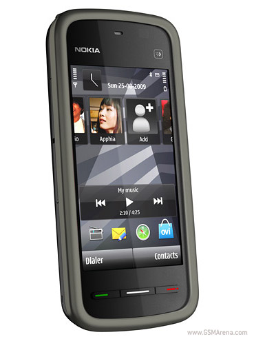
Nokia 5230 comes with 3 inch screen and nokia maps GPS.
Cost around Rs.8300

Nokia 5230 - Full phone specifications

nokia-5230-1.jpg
 
Thad - you are using something on these lines right now in your car?
Nope... I just have the Nokia N82 and use it occasionally for GPS.

I'm waiting for a big screen unit to be much cheaper before I buy for the car, or maybe even picking up some bargain when in UK, which might not be until 2011 now!

But... as things stand at the moment, if I was buying, I'd go for a Garmin unit and MapMyIndia maps. Probably :)
 
After an hours research today it appears the satnav products provide more detailed India maps for Garmin hardware than the mapsofindia version and at very low prices compared to others.

There is also a SatNav bluetooth GPS antenna but it has not been proven to work with iPod touch. My ipod could not connect to my cell phone either.

I found a few good looking iPod apps using google maps called AtlasID and dMap (using OpenStreetMap ). None of them support pinch and zoom unfortunately and are not orientation sensitive - they do not rotate when I turn the iPod (very bad)!! Now to work with the elaborate procedures to save maps offline that I found. Then I also need to find topograhic maps as well. Then I will look at a GPS accessory for the Touch. If all iPod apps fail to satisfy I will look at a GPS phone 4 months down the line. The idea is to try the iPod as hacking toy and push its abilities and features first.

I will update on how the offline maps thing goes in a few days. If anyone finds a free online source of map tiles used by Nokia and Motorola Droid or any other, please post the links :)

cheers
 
Last edited:
Back
Top